Sierra Overhead Analytics Joins Bowman
As of October 2, 2025, Sierra Overhead Analytics (SOA) has officially joined Bowman, a leading national professional services firm offering multi-disciplinary engineering, planning, surveying, geomatics, construction management, environmental consulting, landscape architecture and right-of-way acquisition.
SOA provides civil engineering, hydrologic assessments and precision mapping to deliver efficient, cost-effective tools and techniques for clients across the energy and infrastructure sectors. Our engineering and mapping teams are equipped to meet demanding project requirements wherever your work may take you.
This integration strengthens Bowman’s ability to deliver integrated civil, geospatial and hydrologic solutions, expanding our energy and technology-enabled engineering services. Together, we remain committed to delivering exceptional project outcomes, building lasting client relationships and advancing innovation in infrastructure design and analysis.

ENGINEERING
Advanced Engineering and Site Design Services

MAPPING
Unmanned Aerial Vehicles and Field Mapping

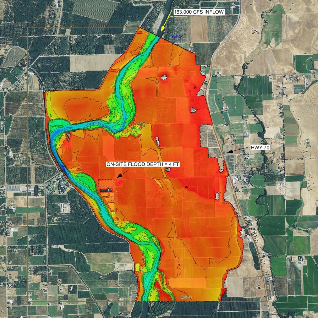
HYDROLOGY
Environmental and Hydrologic Site Assessments